Thursday, September 24, 2015

The Hidden Lakes of Medicine Mountain


                                                  by Jim Goodman

the highway through Ninglang County
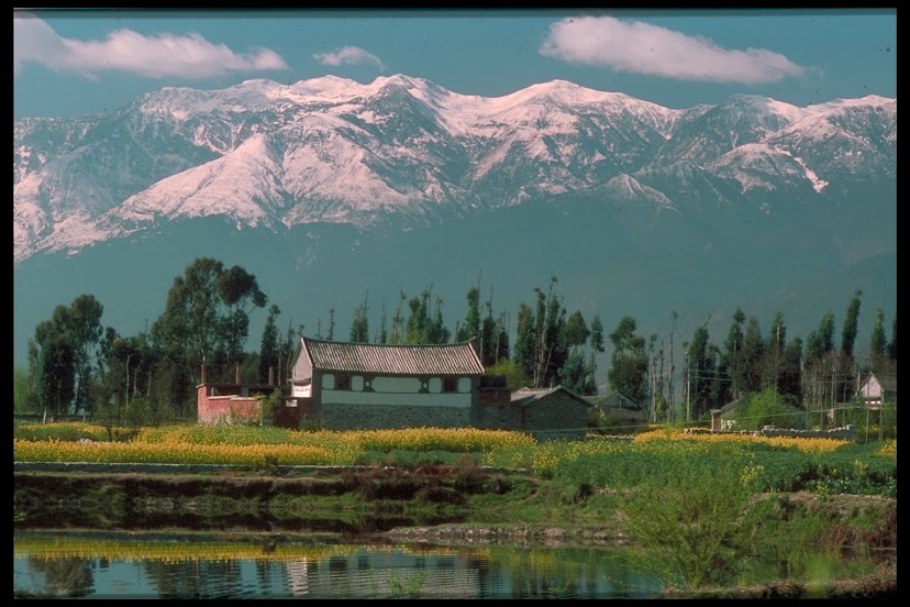
       Like most places in northwest Yunnan, mountains dominate the landscapes of Ninglang County.  Called Xiaoliangshan, the Lesser Cool Mountains, to distinguish them from Daliangshan, the Greater Cool Mountains across the border in Sichuan, they rise on either side of the main north-south highway, sometimes reaching over 4000 meters altitude, blanketed in snow after a late autumn rain, a gleaming white mantle that persists until the warmth of May.  The county’s towns lie in separate valleys along the highway, with mild ascents over the hills between them.
        As with any mountainous area, the higher you hike the greater the view.  But Ninglang County is not noted for its trekking routes.  Visitors to the county almost all head straight for Lugu Lake in the far north and rarely attempt to appreciate anything anywhere else.  As for the mountain scenery, one could argue that it is better and easier to appreciate in Diqing, upper Nujiang or Tiger Leaping Gorge.  Good mountain vistas in Ninglang require strenuous hikes up some rather steep slopes.  And the shapes of the peaks on the far horizons will not rival the higher, more jagged summits of the mountains in the Three Rivers area.
the view north from Yangpinzi in November
      What drew me to these mountains, however, was not the possibility of discovering hitherto unknown scenic panoramas.  Ninglang is a Yi Autonomous County, where the Yi comprise a majority of the population.  And the bulk of them live in the mountains.  Since my purpose in Ninglang was to do research on the Yi, that was going to require some long excursions up the slopes of the Cool Mountains.
       The Yi minority nationality dominates the population of Ninglang city and other county towns.  Visitors will hear more of the Yi language, a member of the Tibeto-Burman linguistic group, than Chinese spoken in the markets and restaurants.  I could find and befriend Yi men who could fill me in on Yi history and mythology, customs and taboos.  Though they were comfortably ensconced in the modern accoutrements of urban Ninglang, they were ethnically conscious Yi, proud of their customs and traditions and I learned much from them.  Their wives were usually from the mountains, their in-laws still lived there, and they themselves made occasional visits as part of keeping in touch with their Yi village roots.
Yo woman, NInglang County
Yi man in the northeastern hills
       Still, there was a limit to what I could learn in Ninglang city, for that was not a traditional environment.  I had to visit the villages and that was going to be physically demanding .  The first village I visited, Yangpinzi, the nearest to Ninglang, took at least an hour and a half of uphill hiking to reach.  But the exertion was worth it.  The people were surprised, but quite hospitable, and the result encouraged me to venture further into the mountains in the future.
       To see the Torch Festival in a rural environment meant hiking uphill all day to a village high up in the mountains northeast of Ninglang.  To visit Bainiuchang, site of a school with bi-lingual education and a special class teaching the written Yi language, I had to endure another steep climb up the slopes east of Ninglang.  In both cases the journeys were worth the effort, of course, just for the cultural experience.  As for the views, they were splendid, yes, but merely as a setting for the encounter, a bonus of a backdrop.
turnip harvest in a Yi hamlet
       Yet on one autumn excursion scenery would prove to be as significant a feature as culture when my Yi friends in Ninglang suggested I should take a hike to the near-legendary lakes of Yaoshan—Medicine Mountain—northwest of the city.  I say ‘near-legendary’ because it seemed many Yi people knew about them but hardly anyone had actually seen them.  And who lived up there?  Yi yak herders. 
       Well, I’d visited a few mountain villages by then and had met Yi barley and buckwheat farmers, turnip and potato gardeners, goatherds and shepherds.  Didn’t know there were any Yi yak herders.  Always thought that was a Tibetan thing.  So when my Yi friend said he could arrange a guide I agreed to go.  The guide was a young man named Jikeu, who worked in the city but came from Jinzigou, a Yi village at the southern foot of the mountain.
Jinzigou village
       We set out along a creek northwest of the city and then had to climb up a steep hill through a thick forest, here and there speckled with blue, white and yellow flowers and piles of fallen russet or yellow leaves.  At the crest of this ridge was a Yi hamlet of about ten houses, with most of the people outside threshing barley or harvesting turnips.  One family called us over for tea and gave us a large radish for us to consume during breaks climbing over the next ridge ahead.
       Though it was just as steep as the first ascent, fortunately the ordeal was over after an hour.  We now gazed down at the sprawling village of Jinzigou in the valley below, with around a hundred buildings, all except the middle school typical traditional Yi log cabins.  Judging by the very friendly encounter we’d just had in the hamlet, I anticipated a warm reception.
Shàhma Lake on Yaoshan
       But things started off awkwardly.  There were stares but no smiles as Jikeu led the stranger through the lanes to his family’s house.  Even there everyone seemed hesitant to greet me.  A short discussion ensued between father and son.  Then the mood suddenly changed and I was welcomed with the same warmth I had experienced in other Yi villages.  Familiar with the custom of compensating the family for their hospitality, I gave out the gifts I’d brought for the hosts; liquor for the father, cowry shells from Thailand for the women to embellish their clothing accessories and a pound of sweets for the children.   And as we settled in for our stay and sipped tea, Jikeu revealed what the discussion had been about.
       Recently there had been reports of strangers going to remote villages in the county to preach the imminence of the end of the world and urge people to join their religion to assure their salvation.  Jinzigou residents hadn’t seen any yet, but some of their relatives in other villages had.  Was I one of those Doomsday prophets?  If so, they really didn’t want to hear that kind of talk.  Assured that I was not, they were pleased to meet and welcome the first foreigner to Jinzigou.
Zhihu Lake
       After a hearty morning meal and a photo session of the family dressed in their best Yi apparel, we commenced our hike to the summit of mighty Medicine Mountain.  We crossed the creek at the edge of the village and the trail almost immediately began zigzagging up a 70-degree gradient.  Much of it went through thick forests of pine, fir, rhododendron and poplar, with moss hanging from the branches, lichens covering fallen logs and bighorn sheep sharing the trail.
       I learned all about false summits that day:  seeing an end to the uphill trail, discovering the level walk only continues five minutes and then another steep ascent begins.  Two Yi herders joined us for the last stretch of the journey, carrying my shoulder bags and cutting a staff from a tree branch for me.  But when we finally arrived at the broad plain lying next to the steeply sided granite rocks on the summit, all the pain of getting there was soon forgotten.  
yaks on the summit of Medicine Mountain
      It was mid-afternoon and our first stop was a hut belonging to an older Tibetan woman, who lived there with her two grandchildren.  She prepared buttered tea for us while Jikeu heated the buckwheat bread his family had given us.  After our refreshment (including a cup of precious corn liquor for the foreigner guest) we headed for a Yi herder’s cabin a short distance away, where we would stay the night.
       This cabin was close to one of the lakes, so after making arrangements for the night we all headed, along with the Tibetan girl, to the lake the Yi call Shàhma.  This small and shallow lake lies in the lap of a steeply wooded slope.  The view from here encompasses the stark cliffs along the summit to the west and out across the wrinkled horizon of the Lesser Cool Mountains.
       We joined our companions as they went up the slopes to fetch their yaks down to the cabin area for the night.  I found these animals very curious about the stranger alongside them.  They often sidled up to me, but whenever I reached out to touch one, the yak backed off.  Still, they were a lot less skittish than their lowlands cousin the water buffalo.  
milking a yak
churning yak butter for Tibetan-style tea
       Yaks rise at dawn and head for their favorite pastures.  Around an hour after sunrise the herders go up to bring them down again.  Then they take one cow, tie it to three stakes and get a calf to start the cow’s udders working.  Then the man kicks away the calf and milks the cow for about twenty minutes.  Much of this will be turned into curd and some processed into cheese and butter.
       Less than ten people seemed to live up here, their economy centered mostly on their yaks.  In the valley markets at that time yak butter sold for 50 yuan a kilo, cheese for a bit more and a fully grown yak fetched 1000 yuan, somewhat higher than a water buffalo or ox of the same size.  While tending yaks, goats and sheep was not physically demanding, their lifestyle was necessarily austere and simple.  For every essential except water, meat and firewood they had to make the long trek down the mountain to Hongqiao, the nearest town, and back up again, their ponies loaded with buckwheat flour, rice, potatoes, salt, oil, tobacco, soap and liquor.
Yawshalavoe Lake
       After a breakfast of buckwheat bread, potatoes, buttered tea and curd, we set out to see the other Yaoshan lakes.  This proved to be almost as grueling an exercise as getting to the summit the previous day.  To get to the second lake we had to hike up above the yak pastures, cross the ridge and descend through a thick rhododendron forest with no clear trail.   This was Jikeu’s first trip here as well.  I had no idea what kind of directions he’d been given, but as I searched the slope for footholds and slid under thick fallen tree branches, I was sure we were lost.     
       Jikeu’s internal compass, however,  functioned brilliantly that day and steered us to an opening on a ridge overlooking Zhihu, the second lake, which also lay in the lap of a steeply wooded cliff.  From here we descended eastwards through another trackless forest, following the trails that martens and rabbits take.  Eventually we arrived at the shore of Vahlilu, the prettiest of the lakes.   A thick rhododendron forest backed its northern shore, with small, partly iced, yellow clumps of grass lying just off the shores of the other sides.  
       We rounded the lake, climbed the ridge behind it and slid down through a forest to the fourth lake, Yawshalavoe, which also lay in the lap of high, forested slopes.  The trees on its eastern slope, though, had all been cut, and big logs lay drying out on the ground.  Someday these would have to be hauled by hand all the way down the mountain. 
Vahlilu Lake
       After a short break here we climbed back over the ridge above the yak pastures and descended to the Tibetan cabin for a meal of buckwheat bread and yak cheese, washed down with buttered tea and, in my case, a final cup of corn liquor.  As it was not yet four o’clock and we were now fully nourished, we bade farewell to our hosts, and their yaks outside the cabin, and descended down the same trail back to Jinzigou, arriving just at dark.  
       Now I was back in the familiar conviviality of a Yi village community, where people interact more often, do many things collectively, celebrate festivals and so on.  How different it was from the lifestyle I had just observed on top of the mountain.  The Yi yak herders reminded me of backwoodsmen in 19th century America, who built a cabin in the forest and, except for provisions trips to town, in the course of the day were more likely to meet a bear than another human.  Yet American culture reveres them as representatives of a fiercely independent spirit.
       Could that not be said for the Yi I met on the mountaintop?  They opted for the solitary life over the community one.  They chose immersion in nature instead of participation in society.  For their occasional pleasures they rely on things like unexpected warm breezes in cold months, an especially brilliant sunrise and the birth of healthy animal.  And for faith, it’s their own proud, independent spirit.

the cabin and yaks of our Yaoshan host
                                                                        * * *                                                             
            for more on theYi of Xiaoliangshan, see my e-book Children of the Jade Dragon

Monday, September 14, 2015

Yunnan’s Muslims: the Hui Minority in Southwest China


                                                    by Jim Goodman

Najiaying Hui village, Tonghai County
       Of all of China’s 56 minority nationalities, the only one that qualified for such designation by religion alone, rather than language or ethnic identification, is the Hui, who are Muslim, but ethnically Han Chinese.  Some of them are descendants of the first converts from coastal ports visited by Muslim Arab traders in the 7th and 8th centuries.  From here they eventually spread further inland, but the main components of what would become a separate Hui identity were Muslim warriors who were part of the Mongol forces that conquered China in the 13th century, stayed in the country, intermarried with local women and, except for retaining their religion, adopted Chinese customs and lifestyles.
       Yunnan’s Hui today number around 700,000, making them the seventh largest minority nationality in the province.  Some can trace their ancestry back a thousand years or so.  But the presence of Muslims in Yunnan vastly increased with the arrival of Kubilai Khan’s invading armies in 1253.  The Mongol forces that vanquished the Kingdom of Dali and overran all of present-day Yunnan included many brigades of Muslim soldiers from Central Asia, who later were the dominant constituents of the garrisons established at Dali and Weishan.
classic Yunnan-style mosque at Gonglang, Nanjian County
       Kubilai annexed Yunnan to the Mongol Empire and appointed Sayid Ajjal (a.k.a. Saidianchi Zhansiding), a Muslim from Bukhara, as Governor.  Reflecting the Khan’s appreciation of Chinese civilization, Governor Sayid Ajjal ordered the construction of not only mosques, but also Buddhist and Confucian temples in Kunming.  He was also a staunch promoter of Confucian education.  His successors followed the same policies and by the end of the Yuan Dynasty Kunming and other cities had a substantial number of Muslim residents.
       When Ming Dynasty armies rolled into Yunnan to expel the Yuan forces, the Mongol units left, but their Muslim allies mostly dissolved into the local population.  Largely SInicized by then, the Hui became a permanent part of Yunnan’s population.  One of their number, Zheng He from Jinning, rose to become the commander of several naval expeditions in the early 15th century that sailed as far as the African coast.
Hui elder, Yao'an County
Hui girls in Dacang, Weishan County
       Throughout the Ming and most of the Qing Dynasty the Hui were a fully integrated part of Yunnan society.  In places where they were numerous, such as around Dali and Weishan, Xundian and Tonghai, they ere farmers like all of their neighbors.  In the cities they were involved in commerce, ran shops and organized long-distance caravans.  With the 19th century industrial development of the province, they also became involved in mining.  But it was a mining dispute in Shiyang, in Chuxiong Prefecture, that sparked disaster for the Hui people in Yunnan.
Hui village on the Dali plain
       Both Han and Hui operated silver mines in Shiyang, but the Han mines were running out of deposits.  When the Hui refused to give the Han employment in their own mines, the Han attacked them, but were driven back to Kunming.  Mandarins in the city pacified the Hui there with promises, but meanwhile a coterie plotted to exterminate the Muslims in Yunnan. 
       Massacres commenced throughout the northern half of the province on 19 May 1858.  Strong Hui communities around Huilong in the east and Dali in the west organized armed resistance and thus the province plunged into the turbulent years of the so-called Muslim Revolt, or Panthay Rebellion, after another name for Yunnan’s Hui.  “Muslim Revolt” is somewhat misleading, however, for after a two-year stalemate in the east, Hui leaders made a deal with the Yunnan government and were given command of a mixed Han-Hui army charged with putting down the rebellion in the west, where the Hui had the support of the Bai, Yi and other minorities.
Du Wenxiu's palace, now the Dali City Museum
     
At the outbreak of the massacres the Hui around Dali, where they were one third of the population, held off Han attackers trying to reach the city in a seesaw battle that changed dramatically with the arrival of Hui reinforcements led by Du Wenxiu.  After routing the Han forces, Du Wenxiu occupied Dali, declared it the capital of a new state—the Peaceful Southern Kingdom (Ping Nan Guo)—and installed himself as ruler with the name of Sultan Suleiman.  He set up an efficient administration, promoted commerce, won the support of most ethnic minorities in the west and southwest and repulsed two attacks by government armies.
students at Najiaying's Islamic Studies Center
       The new state consolidated control over western Yunnan while the Qing government was still preoccupied suppressing the much more devastating Taiping Rebellion in southeast China.  That was accomplished in 1864, but another revolt broke out among the minorities in northeast Yunnan.  Only in 1867 was the provincial government ready to dispatch a large Han-Hui army against Dali.  But it suffered a crushing defeat.  Du’s army pursued the remnants all the way to the walls of Kunming and settled in for a siege.
       This was the high-water mark of the Revolt.  But Du’s forces could neither breach Kunming’s walls nor completely blockade roads to the city.  After several months of trying, Du Wenxiu withdrew his forces back to Dali.  The following year the Qing government started subsidizing arms purchases for a new provincial army.  Under General Yang Yuke the freshly strengthened force captured Ning’er and its salt mines, depriving Dali of its principal source of revenue.
       From Ning’er the Qing army began its slow but relentless drive north to Dali, finally reaching the city gates before the end of 1872.  Du Wenxiu surrendered the following January and committed suicide.  The victors decapitated the corpse, which was buried in Du’s nearby home village of Xiadui, mounted the head on the ramparts and spent another year mopping up the last of the resistance.  
Yunnan-style mosque at Dabaiyi, Eshan County
       Following this, the Qing troops embarked on a horrific revenge campaign, slaughtering any Muslims they could capture.  Thousands fled to northern Burma and northern Thailand, where they eventually got into the caravan trade for the next century and became known as the Jin Haw.  At the Dieshuihe waterfall in Tengchong, a powerful cataract of the Daying River, Qing soldiers hurled hundreds of local Muslims over the precipice to their deaths.  In Dali the Hui were forbidden to live in the city and pursued throughout the plain.  As many as could fled and the government confiscated their lands and parceled them out to the Bai. 
       Government revenge did not extend to the minority populations that had supported Du Wenxiu.  Around Dali the Bai people helped hide their Hui neighbors.  Other Hui adopted the Bai language for everyday use and concealed evidence of their Islamic identity.  Once the heat was off they could be more open about their religious affiliation, but often retained use of the Bai language.  And when the Hui returned after it was safe to do so, the Bai who had benefitted from the land confiscation returned that land to the Hui and helped them rebuild their homes and mosques.
the mosque and Hui quarter in Yangbi
       Famine followed the end of the rebellion, as well as a total breakdown in commerce that lasted for several years.  Twenty years after the outbreak of hostilities Yunnan’s population had declined from 8 million to 3 million.  The province recovered, as did the Hui, resuming their customary roles in Yunnan, taking up their familiar trades, tending their farms and getting back into long-distance commerce by caravan.   A century later Islam and the Hui identity came under attack during the Cultural Revolution, but so did the traditions of everybody else (including the Han).  Mosques were closed or turned over to other uses, but mosques, churches, temples and monasteries across the entire country suffered the same fate.
       With the launch of the Reform Era, Hui culture experienced the same ethnic revivalism that swept Yunnan in the 80s and 90s.  Mosques reopened, drew large crowds for Friday services and imams ran new Islamic Studies Centers and taught Arabic.  The Hui also established links with overseas Muslims, especially in the Middle East, who often sponsored the construction of new mosques, in the Arabian style.
new mosque in Wenming, Eshan County
       Externally, the original Yunnan mosques resembled Buddhist temples in shape and design.  The crescent moon mounted in the center on the top of the roof was one obvious difference, as was the lack of any depiction of humans or animals in the carved embellishments.  Interiors were simple, with a niche in one wall identifying the direction to Mecca.  Many mosques in the indigenous style are still in use in Hui towns and villages throughout the province.  Some are larger, more complex and impressive compounds, sited on hills above the town, such as at Yangbi, south of Dali, and Gonglang, in Nanjian County.
       Other Hui communities have replaced their antique mosques with new ones in Middle East style, featuring gleaming white walls, green or blue onion-shaped domes, towering minarets and capacious interiors, altogether more imposing than the simple structures they replaced.  They are bigger and taller than the originals, like the splendid, three-story mosque at Wenming village, in Eshan County, and the new ones in the heart of Kunming.  They range in style from the grand exuberance of Wenming to the classic proportions of Najiaying to the austere modernism of Yanshan.  And they represent the resurgence of Hui pride.
       Sizable Hui communities live in the northern, eastern and western parts of the province.  Xundian, north of Kunming, and Weishan, in Dali Prefecture, are Hui and Yi Autonomous Counties and every city in Yunnan has a Hui neighborhood.  Kunming has a rather large one, mostly in the area between Jinbilu and Dongfengxilu.  When Yunnan opened its doors to foreigners this became part of the tourist itinerary, less for its classic mosques than for the sight of huge slabs of beef hanging from racks all along Shunchenglu and the Hui restaurants here and in the popular Bird Market nearby. 
young imam reading prayers at a village mosque near Yao'an
       Some Hui-inhabited places qualify as tourist attractions just because of their beautiful settings.  Najiaying, with a new mosque dominating the northern end of the village and an old one in the southern market area, lies beside Qilu Lake in Tonghai County.  Wulichou, on the lower slopes of Cangshan with a good view of Erhai Lake, straddles a stream coming down from the mountains near Dali.  The Hui quarter of Yangbi, the only part of the old city still extant, lies along a road below the classic mosque that leads to an historic bridge on the Tea and Horses Road, a famous caravan route from Pu’er to Tibet.   
       The caravans across Yunnan have disappeared, but the Hui in that business graduated into the modern transportation system.  Urban Hui make up a large proportion of the city taxi drivers and the ones who drive the inter-city buses, vans and trucks.  They kind of announce their identity by posting a decal in the corner of the windshield of a verse from the Koran in Arabic script.  
       Other urban Hui find employment in government service of one kind or another, petty trade and, especially, the restaurant business.  Han Chinese generally like to eat pork, but they also appreciate a good meal of beef now and then and first choice is always a Hui restaurant.  They order a thick beef broth, beef stir-fried with onions, thin slices of roast beef served cold and spiced with chili sauce, a few other special beef dishes and maybe augment the meal with mutton or chicken.
modern mosque in Yanshan, Wenshan Prefecture
       Perhaps the enduring popularity of Hui restaurants, plus the Hui role in transportation, helps maintain the community’s image of a normal, fully integrated part of Yunnan’s socio-economic society.  Hui leaders in China have been at pains to affirm their loyalty to the state and disassociate themselves from any covert sympathy with co-religionists espousing separatism or extremism. 
       Actually, the Hui in Yunnan are certainly devout, but not at all fundamentalist, radical or even very strict.  The women may wear headscarves, but do not dress in the burka associated with extremely conservative Muslims.  The men don the white skullcap for Friday prayers, but may not wear it other days.  Theirs is not an exclusive society wary of outsiders.  As a non-Muslim foreigner, in my own encounters with the Hui, explaining my visit as a desire to learn about one of Yunnan’s minorities, I was always warmly welcomed, invited to observe the Friday prayers, encouraged to photograph and never pressed to join the services.
       It was the same experience I had calling on other minorities.  The Buddhists never insisted I bow before any image.  The Christians didn’t ask me to join in the hymns.  The animists never requested I leave an offering at a spirit altar.  Everyone was pleased just because I was interested in them, and told or showed me everything I wanted to know.  The Hui were no different, just another friendly minority in the ethnic mélange of Yunnan, where harmony and mutual respect are the old and new normal.
Hui children in a Yao'an Cuunty village mosque 
                                                                        * * *


Thursday, September 3, 2015

Khmer at the Mouth of the Mekong


                                                    by Jim Goodman

      
Chùa Chim, a Khmer temple in Trà Vinh
       For most of its history the Mekong Delta was the most underdeveloped, least populated part of what is today Vietnam.  When the first Vietnamese, and to a lesser extent Chinese, began moving here in the late 17th century they discovered a land dominated by water, subject to the flooding of the main branches of the Mekong River, as well as its many tributaries.  In between these lay swamps and bogs and scattered patches of higher land, mostly covered with thick forests. 
       The indigenous population then was nearly all Khmer.  Some lived in the slightly higher plains that now border contemporary Cambodia.  But the bulk of them lived near the mouth of the Mekong, on lands straddling the Hu River branch, what now consists of Trà Vinh and Sóc Trăng provinces.  Even today 70% of Vietnam’s Khmer minority lives in these two provinces.  Vietnamese migrants didn’t try to expel them or take over their lands.  They simply moved next door, cleared swamps, constructed canals and made new farms.  Khmer communities remained in place, governed by their own chieftains.
Angkor Era relic at Chùa Phướng
7th-8th century Lokeswar from Trà Vinh
       That autonomy lasted until Minh Mng’s administrative reforms in the 1830s.  Vietnamese became a majority in both provinces by the 20th century.  But Khmer culture and traditions have persisted nevertheless.  The Khmer still comprise about 30% of the population in both provinces, mainly village people, with active temples and a strong ethnic consciousness.
Ao Bà Om
       No records exist of when the Khmer first settled here, but it was perhaps not long after the collapse of the Funan state in the 6th century, if not earlier.  A beautiful stone carving of the Mahayana Buddhist deity Lokeswar, found in Trà Vinh province and dated 7th-8th centuries, in the classic Khmer style, is equal to anything produced in the Cambodian heartland at that time.  It is on display in the History Museum in H Chí Minh City, along with a pair of exquisite stone, life-sized devis (unfortunately missing their heads and lower arms) from the 11th century, also from Trà Vinh.  Obviously, the Khmer cultural connection between Trà Vinh and central Cambodia goes back a long way.
Khmer devotees at Chùa Hang
       Other evidence exists of Trà Vinh’s ties with the ancient Angkor Empire.  The artificial pond Ao Bà Om, a few km from Trà Vinh city, dates its construction to over a thousand years ago and many of the temples standing today replaced earlier ones that, during Angkor times, honored Hindu or Mahayana Buddhist deities.  Chùa Phướng, on the outskirts of town, kept the ruins of one of the ancient buildings in its courtyard.  The stone staircase features railings with the original Buddhist heads in a style familiar to anyone who has visited Angkor.
       In religious matters, Khmer culture in Trà Vinh shifted to Theravada Buddhism around the same time as in the Cambodia heartland.  The first Theravada Buddhist temple in the province went up around 1450, about twenty years after the first Theravada temple in Cambodia, at Phnom Penh.  Khmer cultural development in Trà Vinh and Sọc Trăng ran parallel to that in central Cambodia, but political and administrative ties are less certain.
classical dance masks in the Khmer Cultural Museum
     
The two provinces are as far downriver from Angkor, or subsequent Cambodian capitals like Udong or Phnom Penh, as one can go.  Very few settlements existed between them and eastern Cambodia.  There were no big urban centers and the economy was simple, self-sufficient agriculture.  The area was not so heavily populated to be of any crucial economic importance to Cambodian governments.  It is difficult to imagine Angkor or subsequent regimes sending tax collectors or military recruiters that far away from the capital.  The Khmer at the mouth of the Mekong enjoyed virtual autonomy from the time of their first settlement until their absorption into the Vietnamese state.  Yet this political integration and the occasional assimilation campaigns in the past have not diminished the Khmer attachment to their religion, language and culture.
       Though Trà Vinh’s growth as an urban center only commenced with the early 18th century immigration of outsiders, the city today still exudes a strong Khmer atmosphere.  A large percentage of the schoolchildren are Khmer, as are many of the merchants in the covered market or on the street beside the river, easy to recognize by their darker skin complexion.  The town has several attractive Khmer temples and small groups of saffron-robed monks on a stroll through the city are a common sight in Trà Vinh.   
riverside market, Trà Vinh
       The Vietnamese form the majority of the city’s roughly 75.000 residents and several Mahayana Buddhist temples cater to them.  Trà Vinh also has a church for its Catholics and two temples for adherents of the Cao Dài faith.  The small but active Ông Pagoda, founded by Chinese immigrants from Fujian in the town’s commercial center in the 16th century, serves the local Chinese business community, while a relatively new temple on the northern side of the city to the Goddess of the Sea attracts those in the fishing trade.  
       Most of the town, including its temples, hotels and commercial center, lies along the west bank of the Long Bình River, a small, moderately busy tributary of the Mekong, into which it flows several km north of Trà Vinh.  Most streets in the residential neighborhoods are lined with tall, shady trees, unusual for a Mekong Delta town, which keep the temperatures bearable even on hot, sunny days.   Trà Vinh doesn’t offer much in the line of entertainment:  no discos or bars.  But there are a few places where one can enjoy cold beer and grilled seafood like scallops, oysters, sea snails and the tasty Delta specialty called ‘finger snail,’ a kind of elongated clam, baked with spices in its finger-length shell.   
'finger snail'
       While it’s a pleasant, uncongested place to stroll around, the main attractions in the town, and the province as a whole, are its Khmer temples.  Architecturally, they are noticeably different from the Mahayana temples of the Vietnamese and Chinese, as well as the Catholic and Cao Đài churches, resembling instead the Theravada temples in Cambodia, Laos and Thailand, featuring tall, angled roofs that immediately mark their Khmer identity.
       No two are exactly alike, but they do share a number of common characteristics, both in structure and in decorative elements.  Except for a couple of smaller temples in the city center, Khmer temple compounds are walled, with fancy entrance gates, enclosing a spacious area with several buildings and groves of big shade trees.  The religious buildings rest on raised plinths, the main hall rectangular, with sloping, tiered roofs, supported either by the buildings’ exterior walls or a row of pillars.   Angled support struts, carved with images of mythical beings, half-woman, half-bird, are lined along the lower roof edges on both sides of the building, connected to either the walls or the pillars. 
unusual relief carving 
       The interior will feature a large seated Buddha, often with distinctly Khmer features, as well as a number of smaller, standing or seated Buddhas.  The walls inside will likely be covered with frescoes of Buddhist mythology and scenes of everyday life. 
       Variations in this basic design are legion.  It could be a single roof or double.  The walls on each of the longer sides of the building could be solid or scalloped with open areas.  The pillars could be plain or covered with painted patterns.  The buildings could be white, yellow or something else.   In the garden behind the main hall, or to the side or even in front there may be life-sized sculptures depicting famous scenes from the life of the Buddha, such as his first seven steps after birth, the Temptation of Mara, the first Sermon, etc.  There may be columns surmounted by a four-faced Bodhisattva, derived from the famous image at the Bayon in Angkor Thom.  There may be odd relief sculptures on walls inside the compound, like deities riding pigs, or statues of Khmer historical heroes.
Chùa Âng
       Certain temples in the immediate area boast of unique features.  Chùa Phướng, on the southern edge of the town, has its preserved Angkor-era relics.  Chùa Chím, in a wooded area on the western outskirts, features a miniature replica of Angkor Wat and the Bayon in the garden behind the main hall.  Chùa Âng, five km southwest of Trà Vinh and the most venerable in the province, lies beside the ancient pond Ao Bằ Om and is opposite a Khmer Cultural Museum.
        According to local legend, the creation of the pond originated with a dispute a thousand years ago over who had to pay for wedding expenses—the groom’s side or the bride’s.  So they decided on a contest to resolve the issue.  The women would build a square pond, the men an oval one, and whoever was nearest completion by daybreak would be exempt from wedding expenses. The women won by a trick.  Before dawn they lit lanterns to brighten the sky and fool the men into thinking the night was over.  They laid down their tools but the women continued.  When daybreak really did arrive it showed that they had won.  The oval pond no longer exists, but the women’s pond Ao Bà Om today is a popular retreat for city folks.  Tall trees surround the pond, many of their roots rising above the ground in weird and grotesque shapes.  The Àng Temple next door was originally a Hindu temple in the Angkor era and a Theravada temple replaced it in the late 15th century.  It has since been restored a number of times, including fairly recently.
       The museum across from Chùa Âng has a nice display of items relevant to the religious and material life of Khmer people.  Among the exhibits are all the traditional tools and devices used in agriculture, baskets of sundry kinds, wooden containers, mortars and boxes, hunting and fishing gear, musical instruments, temple decorations and dance masks.  On one wall are the founding dates, locations and photographs of all the major temples in the province.
decorative carving, Chùa Âng
purification rite, Chùa Âng
       Most of these lie south and southeast of the city, where nearly all the villages are Khmer, their locations marked by entry gates on the main roads with very Angkor-like images.  A turn down one of these roads takes one past rice fields backed by sugar palms and eventually reaches the temple compound, walled and forested, that lies at the edge of the residential area.
       Village houses generally sit on both sides of a canal or stream that bisects the settlement.  Trees and bushes obscure the banks and hide the water except at the several bridge crossings.  While they may do some fishing from the bridges, villagers don’t use boats to get around.  The unpaved roads through the village are barely wide enough for a car, but local vehicular traffic is all by bicycle or motorbike, anyway.  Small shops and refreshment stalls stand at major junctions, like the ones that turn back towards the main provincial roads. 
Khmer houses of split palm leaf, Trà Vinh province
       Throughout the residential area groves of sugar palms and other trees occupy every space not used for a house or a garden.  The houses, generally one story and resting directly on the ground, are not clustered but stand alone or in groups of two to four related families and are from twenty to fifty meters apart from the nearest neighbors.  Some of the wealthier villagers have houses of brick or cement, but most houses are simple structures employing split palm leaf for the walls and roofs. 
       Villagers’ lives revolve around the labor demands of an agricultural economy and the obligations of their religion.  Neither is very strenuous, for the work is only heavy at the time of planting or harvesting, when they do it collectively.  And while pious villagers make voluntary contributions to their local monastery, gifts that have sustained maintenance of the religious buildings, because monasteries are required to grow their own food, they do not have to get out in the morning to fill monks’ begging bowls. 
miniature Angkor Wat and the Bayon at Chùa Chim
       The principal characteristics defining Khmer culture and identity are language and religion, both of which appear to have good future prospects.  Instruction in the Khmer language was formerly only available to boys who enrolled temporarily in the monasteries. Nowadays Khmer is one of the three minority languages in Vietnam (the   others are Giarai in the Central Highlands and Hmông in the north) authorized for bi-lingual education at government-sponsored schools, abetting the language’s preservation and development
       As for Khmer Buddhism, the continuing active role of the monasteries in socio-cultural life, respect accorded to monks and the popularity of regular rituals and festivals indicates its persistent, deeply ingrained strength.  This religion has sustained the Trà Vinh Khmers throughout the vicissitudes of the past several centuries.  Neither it, nor the culture behind it, is likely to fade away anytime soon.

Khmer monks in Trà Vinh city

                                                                                 * * *                                                                          
              Trà Vinh is one of the stops on our cultural-historical tour of Vietnam.  For details see                                                                          http://deltatoursvietnam.com