by Jim Goodman
Mandalay, Myanmar’s
second largest city, lies virtually in the center of the country on the east
bank of the Irrawaddy River. It
was the last capital of independent Burma before the British conquest in 1885
and the removal of the capital to Yangon in the south. The city had served as the administrative seat of Burma’s
final kings only since 1860, three years after it was built. The location was not very far from
previous royal capitals, all of which lay within the heartland and principal
power centers of the Burmese nationality throughout Myanmar’s history. The Shan dominated the areas to the
north and the Mon, until the mid-18th century, had their own states
in the south.
 |
| Sagaing |
Bagan, capital of the first
Burmese Empire, lies downriver to the southwest. From the 10th to the 14th centuries it
held direct control over most of the Irrawaddy Valley and exercised its
authority as far east as the edge of the Khmer Empire in present-day
Thailand. When it collapsed after
the Mongol invasion it broke up into smaller rival states that fought each
other, as well as Shan and Mon rivals, disappearing and re-appearing, expanding
and contracting, over the next several centuries.
Sagaing, on the west bank of
the Irrawaddy 20 km downriver from Mandalay, took an early turn as capital in
1315. Today the site is a temple
and stupa-studded group of low hills, with a small administrative and
commercial center along the shore.
With over 500 monasteries and more than 6000 resident monks and nuns,
the town today is primarily a Buddhist retreat and meditation center. Connected by bridge to the other bank, Sagaing
is popular as a quiet day-trip for Mandalay residents seeking respite from the
congestion of the big city.
 |
| Burmese warrior, Bagaya Kyaung |
If tranquility, supplemented
by good scenery, is the goal of the day’s excursion, it doesn’t take long to
achieve that in Sagaing. The hills
are still heavily wooded, dappled with white or gold stupas popping up above
the tree lines, each summit crowned with a temple compound. Paths lead from the shoreline up
to each of these, passing through the quiet forest, with views at the top of
the river and bridge, distant Mandalay, the plains to the west and the stupas
and monasteries on Sagaing’s other hills.
Whatever palace or
fortifications Sagaing might have had in the past have disappeared. Its run as a royal city lasted just
under fifty years. Its own king
moved the capital across the river to Inwa. This was an altogether more defensible location, for a canal
connected a tributary with a bend in the Irrawaddy, making the new capital’s
site an island. Even today the
only way to access Inwa is by a small ferry.
 |
| the walls of Ava |
The new state saw itself as Bagan’s
successor and tried to re-establish the former empire. After some initial success Inwa, or Ava
as it was later known as to the West, got bogged down in a debilitating
40-years war with the Mon in the south towards the end of the 14th
century. The following century
components of the state broke away and in 1527 the Confederation of Shan States
captured Ava and made it their own capital. Just 18 years later, however, the Burman state of Toungoo,
further south, which had seceded in 1510, captured Ava and annexed its
territory.
Under Bayinnaung the kingdom
expanded to include most of contemporary Myanmar, as well as northern
Thailand. But after his death in 1581
the kingdom soon lost all its possessions, only to revive under one of his sons
and re-establish itself in 1599, this time putting its capital in Ava. The Toungoo Dynasty lasted until 1752,
when Mon forces captured Ava. A
few years later Alaungpaya, a Burmese lord from Shwebo, 115 km northwest of
Sagaing, rallied Burmese and Shan and launched a campaign against the Mon.
 |
| Inwa village girls |
After five years Alaungpaya
captured the Mon stronghold at Bago (formerly known as Pegu) and established
the Konbaung Dynasty on a firm footing.
His capital originally was his hometown Shwebo. A moat and some of the city walls still
remain there. But after his death
in 1760 his son transferred the capital to Sagaing for a while and then to Ava
again in 1765. Upon his death the
next monarch King Bodawpaya shifted it to Amarapura in 1783, eight kilometers
northeast. His successor Bagyidaw returned
to Ava in 1821, then went back to Amarapura in 1837 after an earthquake leveled
most of Ava.
Altogether Ava served as a
royal capital of one state or another longer than any other city since
Bagan. Today, though, little
remains to suggest its former glory.
Parts of the city walls still stand, as well as one of its 19th
century towers, two outstanding temples and several stupas. Part of this is due to the fact that
Ava was never a very big metropolis to begin with, certainly not on the scale
of its nearest rivals in Angkor or Ayutthaya. Its kings lavished money on palaces and stupas, but until
its last turn as a capital, not on temples. Also, except for its walls, the buildings were mainly built
of wood and what survived the earthquake was mostly dismantled and removed to
furnish the buildings in Amarapura.
 |
| Bagaya Kyaung |
Not everything was removed,
though, nor did it become a completely abandoned place. Villages of stilted houses made from
wood and split bamboo, with thatched roofs, exist today in parts of the
island. Whether their ancestors
stayed behind after the Court and government left permanently for Amarapura or
were outsiders who moved into the deserted area afterwards, today they work
farms on land where palaces once stood, catch fish in the river and canal, revere
and maintain existing old stupas and send their children to school at Bagaya
Kyaung Monastery, one of the premier attractions of a tour around the site of the
ancient city.
Boats drop visitors off at a
dock near the northern gate. Here
the pony-carts wait to take them around, the usual way to explore the
sights. The leisurely ride takes
two to three hours, depending on how long you stop to examine details. It begins with the biggest remaining
section of the brick walls that once surrounded the royal city. Some of the foundations and an old
brick stupa lie in the vicinity, flanked by rice fields. The pony-cart ambles along a dirt road
past more fields, occasional small stupas, ponds and groves and soon arrives at
Bagaya Kyaung.
 |
| manuscript case inside Bagaya Kyaung |
Constructed in 1834 of strong
teakwood, utilizing 267 posts as support, with sloping red roofs and a slim,
five-tiered central steeple, the building was sturdy enough to withstand the
earthquake a few years later. Many
of the pillars and sections of the wooden railing around the base of the main
temple feature outstanding carvings of birds, elephants, lions, warriors, kinnarees (half-bird, half-woman),
Buddhas and other imagery and embellishments from the Buddhist tradition.
Within the temple a seated
Buddha image rests on a large, ornate, gilded chair. Elegant, carved and lacquered manuscript cases, one atop a
low table, one mounted on wheels, stand near the altar. In the mornings village boys attend
school in one of the side rooms.
 |
| Maha Aungwe Bazan monastery, Ava |
Ava’s other extant temple, the
Maha Aungwe Bazan monastery, went up in 1821, at the start of King Bagyidaw’s
reign, when he shifted the royal residence back to Ava from Amarapura. His chief queen, Meh Nu, sponsored its
construction as a residence for the royal abbot. Unlike most structures at that time, rather than wood the
compound was built with brick and stucco.
The overall pale, dull yellow color is in contrast to the dark brown and
bright red that characterizes Bagaya Kyaung. It suffered some damage during the earthquake, but did not
collapse and in 1872 the Court in Mandalay ordered its renovation.
 |
| Nyanmin watchtower, Ava |
The earthquake affected the
old royal palace more and today only the two-story Nyanmin watchtower remains. Standing 27 meters high, of the same
pale yellow brick and stucco as Maha Aungwe Bazan, it tilts slightly and from
its upper level one has a view across the island and as far as Sagaing. Parts of the city wall foundations, the
remnants of a fort on the southern side and several old and new stupas complete
the list of Ava’s historical vestiges.
The rest of the island is a picture of typical rural life, of
self-sufficient farmers growing their food, making buildings of local materials
and weaving their own cloth, much as they did when Ava was a Kingdom.
Amarapura’s second turn as
royal capital proved to be shorter than its first. Following the Second Anglo-Burmese War of 1852, in which the
British seized the rest of Lower Burma, augmenting the acquisition of Arakan
and Tenasserim it had won after the first war three decades earlier, the Court
deposed the ruling monarch and appointed King Mindon to rule. In 1857 he inaugurated the building of
yet another capital, this time at Mandalay and in 1860 transferred the
administration to the new site. As with Ava after its post-earthquake
evacuation, timber from the royal palace in Amarapura was used to construct the
new one in Mandalay.
 |
| temple in Amarapura |
Today Amarapura is practically
a southern suburb of sprawling Mandalay, but a quiet and attractive suburb
nonetheless. Weaving goes beyond
household requirements here and Amarapura is a major supplier of hand-woven
textiles to the Mandalay markets.
Villages on its perimeter specialize in Buddha images and temple
furnishings like stupa crowns. A
couple of dilapidated buildings remain around the former palace area, but most
of the remains of the old city are stupas and monasteries, none very ancient
and most relatively new,
No two stupa shapes are alike, though,
and besides the customary white or gold color, Amarapura stupas can be, wholly
or partly, red, yellow,
 |
| painted stupe in Amarapura |
blue-green and light green. The temples tend to have wide fronts and a
proliferation of statues, most of them lying on the north and east sides of
Taungthaman Lake. This picturesque
body of water is adjacent to the old city site and in the dry season is often
active with boats and fishermen on the water and farmers working on the shore.
Spanning the southern portion
of the lake is Amarapura’s most famous relic—U Bein Bridge. Using 1060 wooden posts taken from the
demolished royal palace in Ava, it starts from the Maha Ganayon Kyaung
monastery, the residence of a few thousand monks on the west bank, and runs 1.2
kilometers to the other side, terminating a short walk from one of the area’s
finest temples—Kyauktawgyi Paya.
It is the longest teak footbridge in the world and still in regular use,
with five covered rest houses at regular intervals. Monks from the temples at either end cross the bridge in the
morning with their begging bowls, fishermen cast lines from it and villagers
carry goods or push their bicycles across it all day, but especially in the
late afternoon.
 |
| U Bein Bridge, Amarapura |
How much more active it might
have been when Amarapura was still the capital is a matter of speculation. It’s nice to imagine royal processions
marching across the bridge on state holidays or perhaps military units dashing
over it en route to a battle site, but there are no eyewitness accounts from
the past to verify such a vision.
But in1860 the bulk of the city’s population had relocated to Mandalay,
leaving only the people of Taungthaman village and the monks with any need for
it. Though heavy monsoon rains
could fill the otherwise shallow lake to a level as high as the bridge, its
solid initial construction has assured its durability from the beginning.
 |
| Kyauktawgyi Paya |
 |
| villager on the U Bein Bridge |
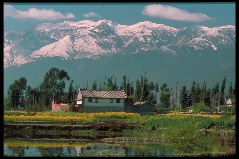
Mandalay’s layout and
architecture followed the forms established by previous capitals. Its royal palace was modeled on the
ones at Ava and Amarapura. A moat
surrounded its rectangular compound, as at Shwebo and Ava. Its temples and towers featured the slim, multi-tiered
steeple like that used at Ava’s Bagaya Kyaung. Stupa shapes copied those erected in prior centuries. And the temples and stupas scattered
across heavily forested Mandalay Hill resembled one of the similarly speckled
hills of Sagaing.
Mandalay, of course, unlike
its predecessors, continued to grow long after its termination as a royal
capital. It may be too congested now
for some to enjoy its attractions undisturbed. If so, or if you are curious to see the original models for
these sights, three former royal cities, quiet, interesting and atmospheric,
lie just a short distance downriver.
 |
| Thaungtaman Lake beside Amarapura |
*
* *
No comments:
Post a Comment